With one of the most epic Septembers on record for surf in the North East, surfers had hoping the momentum would continue into the Winter. As February started winding down - surfers throughout the Northeast were itching for some more action... you could count on one hand the days of decent surf since the beginning of the year. Towards the end of February, the models started showing signs of life and March started to look better and better.... and so begun our run of Nor'easters.
March was an insane month for weather here in Rhode Island (and much of the NE) - with what seemed like an endless amount of precipitation and wind on a weekly basis. With so much activity - we became obsessed over wind and wave models and our eyes were always glued to the buoys. After such an active month - we thought it would be cool to look in the rear view mirror for a minute and breakdown each of these unique storm situations.
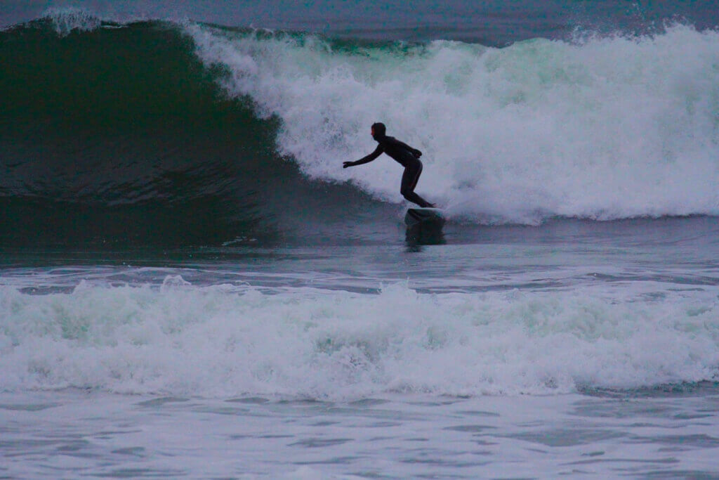
WINTER STORM RILEY - MARCH 1 - 5
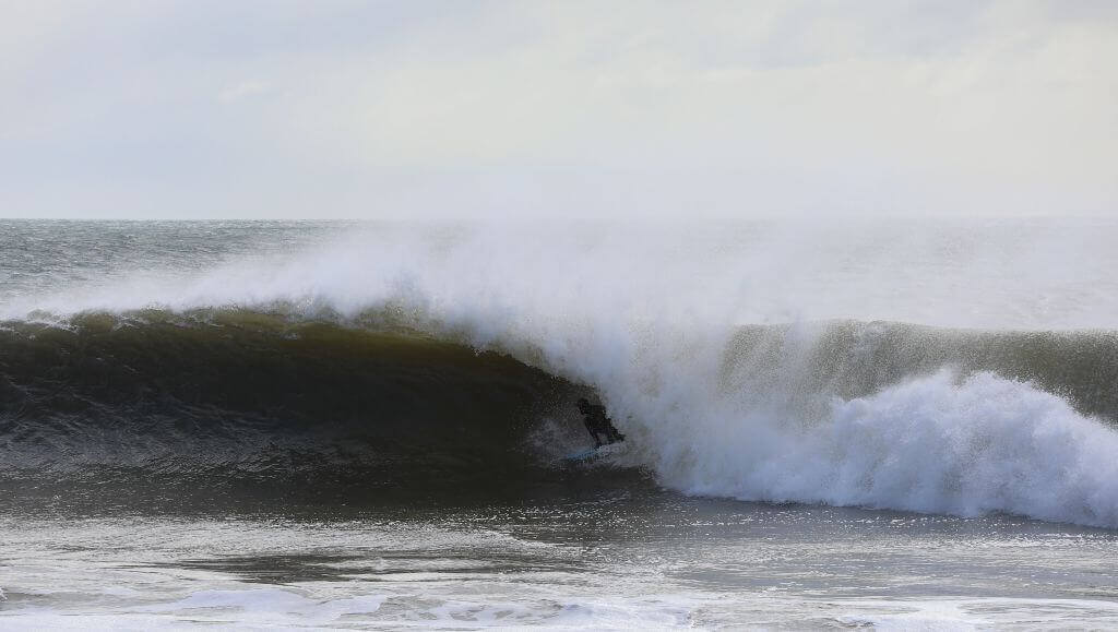
Kevin Babcock navigating thru a freight train courtesy of Winter Storm Riley. Photo: Clark Leonard
Riley originated in the Midwest and moved east towards the Northeast
On March 1. The low pressure formed rapidly off the coast
On March 2 and slowly moved around the coast until it peaked (undergoing " bombogenesis")
and then slowly continued west out to sea by March 3rd. The system produced hurricane force winds from the Carolina's through Massachusetts, and extreme storm surges caused major flooding and property damage - especially along Cape Cod and Scituate, MA.
Winter Storm Riley slowly continued out to sea as it continued to pump ESE groundswell into our swell window. The system produced surf starting on Friday, March 2 and lasting through Wednesday, March 9th - with the swell period progressively getting stronger and stronger. Although the event was not as macking as the major forecasting sites led us to believe (partly due to the amount of E in the swell) there were still plenty of days in the overhead range - and if you knew where to look you surfed 6-7 days straight which is quite the feat for surfers in New England.
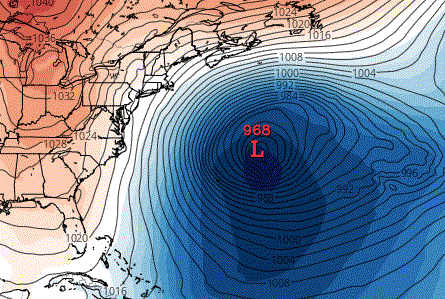
GFS model showing Riley parked west of Bermuda (Source: Tropical Tidbits)
Want to see more on Riley? Check out this killer article with photographer Clark Leonard following the swell from Winter Storm Riley from RI to FL.
WINTER STORM QUINN - MARCH 2 - 9
Shortly after Riley passed by and was still pumping surf our way - another Nor'easter formed, Winter Storm Quinn. Though Quinn was not the ideal swell producer - it dumped a good amount of snow on the region and reinforced the run of surf from Riley as it started to fade - giving us another day of surf at the end of one of the best runs we had since September.
WINTER STORM SKYLAR - MARCH 11 - 14

NOAA satellite GOESEast captures image of WS Skylar southeast of RI.
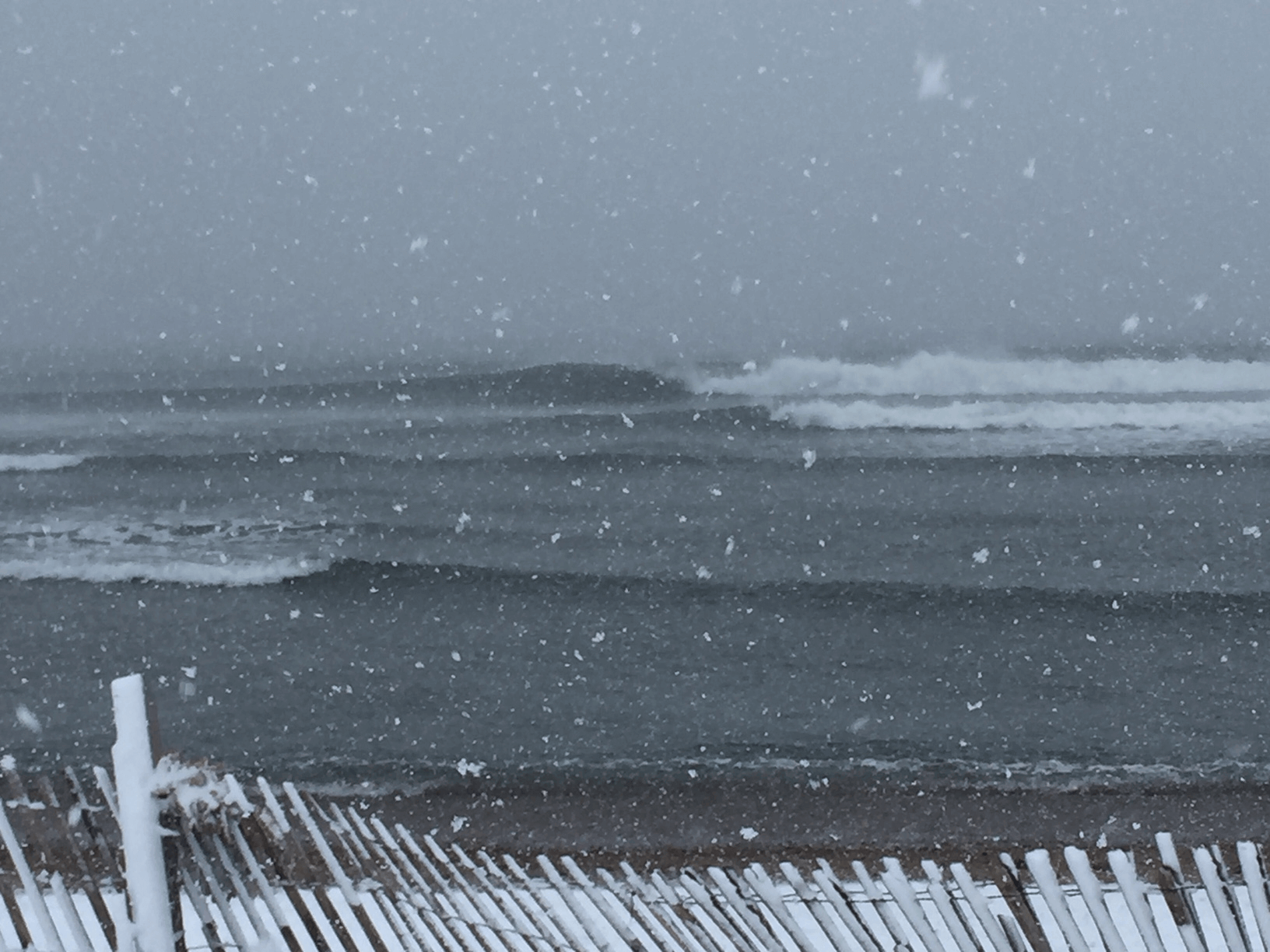
More Snow! Winter storm Skylar was another major Nor'Easter that affected the Northeast - undrgoing bombogenesis once again dropping from 1001 mb to 974 mb in under 24 hours. This storm was the 3rd major Nor'Easter to affect the NE in 11 days! The storm dumped a boat load of snow on all of RI and MA, with hurricane force winds knocking power out once again for much of RI. The storm was at it's peak on Tuesday, March 13th and fortunately for us the winds went offshore in the afternoon which made for some pretty killer conditions if you were up for a paddle!
WINTER STORM TOBY - MARCH 20 - 22
The fourth Nor'easter - at this point people started to get on edge. Four major storms in four weeks?! The center of the storm passed just south of RI, and luckily the winds were not as intense along the south coast as the other storms. There were periods of snow and rain, but nothing that was sticking or causing major issues in RI (some areas of MA were a different story). The system produced some fun waves, but were bit smaller than the previous three Nor'easters. The close proximity of Toby didn't allow any appreciable swell to organize and gain strength, therefore the waves were on the weaker side and did not stick around for too long. There were still some good windows of surf to be had - especially at southern facing breaks at the better tides.

Model run showing Toby and it's close proximity to RI (Source: Tropical Tidbits)
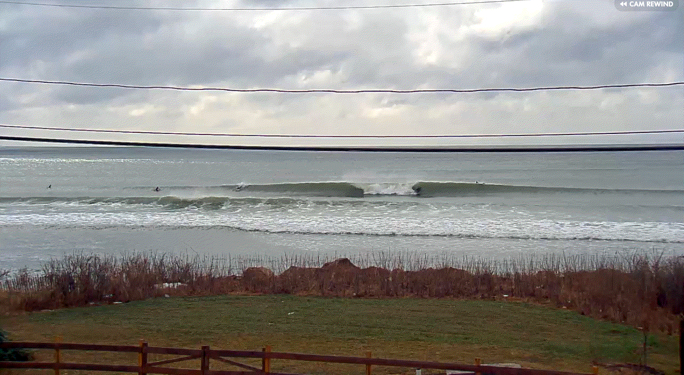
Surfline cam screen grab showing chest high surf in Matunuck. (Source: Surfline)
MARCH 24 - 28
This was a close one! An extra tropical low that formed after moving off the southeast almost became the 5th Nor'easter for the month of March! Although the storm did not quite gain the strength needed to become a named storm, it set up some solid ESE swell for the Northeast as the system slowly moved north and lingered in the west Atlantic before continuing the journey Northeast. This was the last hoorah for March - and what a way to go out! Swell filled in on March 27th and 28th in the chest to shoulder high range with standouts seeing surf in the head to overhead range at the better tides.
Hans Wakeman lining up just before dark on the last swell of March. Photo: Sandy Wakeman.
Waves have slowed down a bit since March, but you shouldn't count out Spring! Although its undeniable that as we get closer to summer waves start to decline - Spring is typically the second best season for surf here in the Ocean state (with the Fall taking the #1 spot). We can't expect the surf to be as consistent as March, but we should see some weaker (but still fun) windswell pop up here and there over the next couple of months..and the good news is we can slowly start shedding the rubber.